Pilchers Hill
Route Geilston Creek - Pilchers
Location Eastern Shore Hills
Route Summary A short walk along a fairly recently constructed walking track, although the optional return route is not so pleasant with a downhill section of steepish and loose gravelled 4wd track. Orange track markers highlight the route.
Walk Description


4WD descent track
Start Point Geilston Creek
Route Grade Short and medium due to return track
Route Distance Klms 4.5
Days 1
Time Hours 2
Related Links
GPS Files - Google Sites
Location Eastern Shore Hills
Route Summary A short walk along a fairly recently constructed walking track, although the optional return route is not so pleasant with a downhill section of steepish and loose gravelled 4wd track. Orange track markers highlight the route.
Walk Description

Rock arch bridge
Initially the road must be followed as you need to park before the end. On this occasion the car park on the short gravel part of Geilston Creek Road was used just off the highway. A walking path joins to a second part of the road, bitumen, and then continues to the reserve entry gate. At a marked junction take the right hand track which is of walking standard which can be seen to have been only constructed in recent years. It is a very nice track and winds up the valley and hill with a rock arch bridge crossing of the creek. Near the top it reaches a 4wd and a short distance above is the summit and water tank. The return can be on the same track or on the 4wd from the last junction by going right (north east), but it has a steep section that needs care as the gravel could be slippery.
Hopefully the Clarence Council will construct a loop track to the same standard as the inward one.
The council notes indicate that Pilchers Hill Reserve in Geilston Bay comprises of 165 hectares of bushland located in the Middle Meehan Range. It contains grassy forest and woodland and is home to wildlife including wombats, wallabies, bettongs, bandicoots, potoroos and many birds. There are several walking tracks within the reserve.
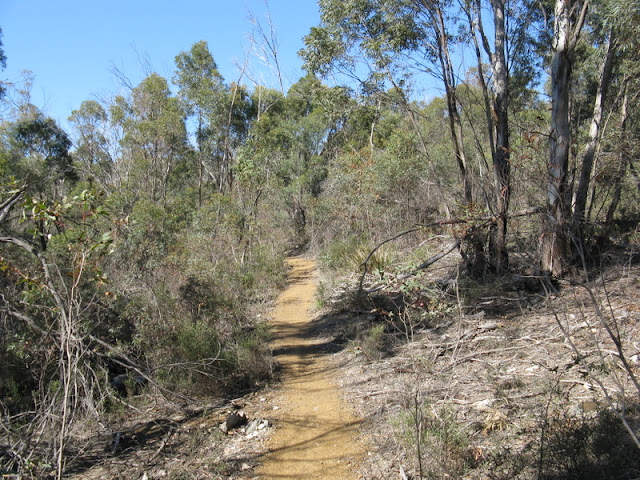


4WD descent track
Distance 4.6k and 1:40 for then loop walk.
Last Updated Sunday, 30 August 2015 Start Point Geilston Creek
Route Grade Short and medium due to return track
Route Distance Klms 4.5
Days 1
Time Hours 2
Related Links
GPS Files - Google Sites
Comments