Mount Field West
Location Mt.Field Alpine Region
Route Summary Walk to a peak on an alpine plateau in the Mount Field National Park
Summary
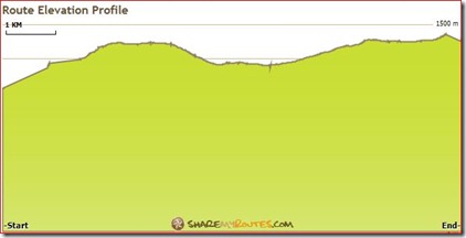
Climb over the rocky screes of the Rodway Range and descend to K Col. The track follows ridge to Clemes Tarn then steadily ascends to Naturalist Peak (1428m) From this point is crosses the plateau to the summit.
On reaching the plateau there is a small creek with cold running water.It takes about 4 hours to reach the summit
Map Dobson
Last Updated Sunday, 8 April 2012
Start Point Lake Dobson
Introduction A significant rock scree has to be negotiated over the Rodway Range and the plateau can be difficult to navigate in misty weather.
Hazards Rock screes
Route Conditions Some significant rough sections
Facilities Toilets only at start. A shelter hut at K Col
Route Grade Long and medium hard
Route Distance Klms 17
Days 1
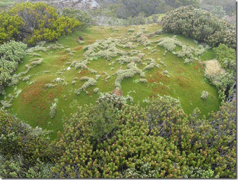
Features Cushion plants and tarns on plateau
Time Hours return 8
Height Gain metres 409
Distance to Destination 8500
Gradient 1:20.8
Related Links
http://www.sharemyroutes.com/routes/Australia/Fitzgerald-Derwent-Valley-
Tasmania/Field-West-Mount/details.aspx
http://bushwalks.blogspot.com.au/2012/04/field-west-mount.html


Comments